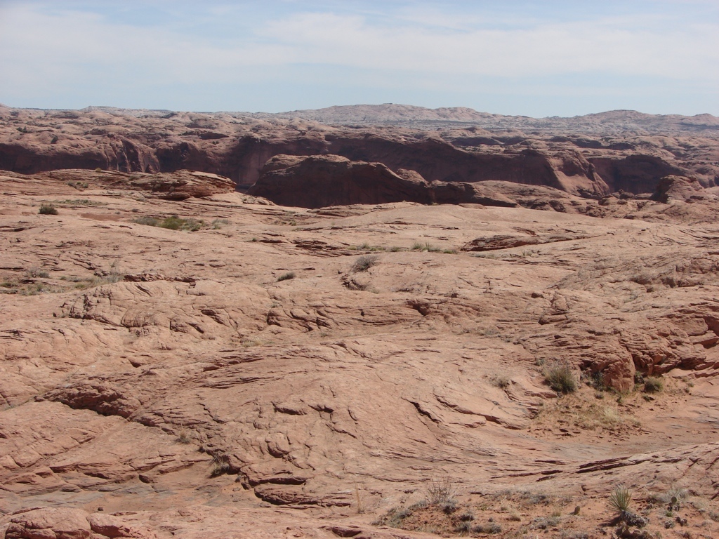
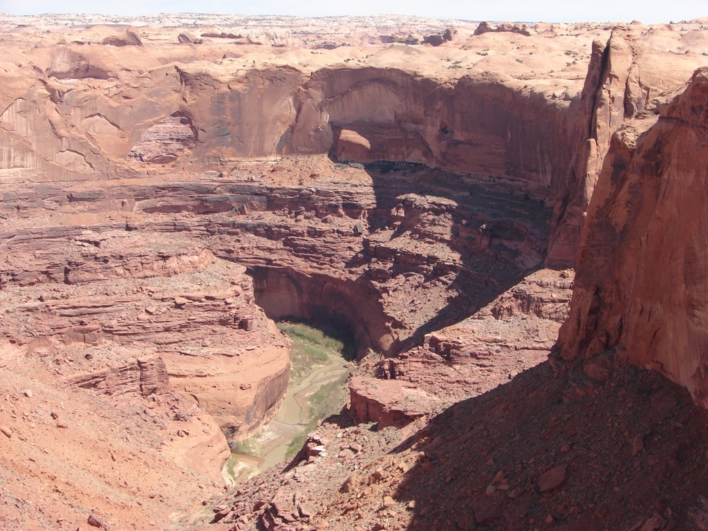
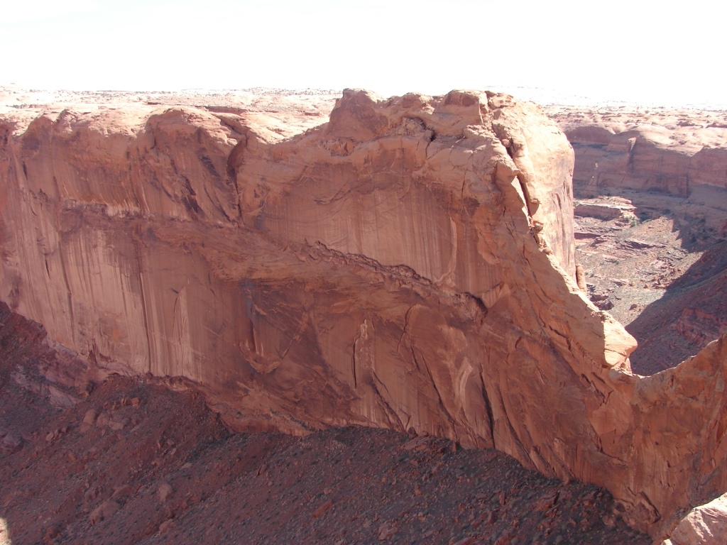
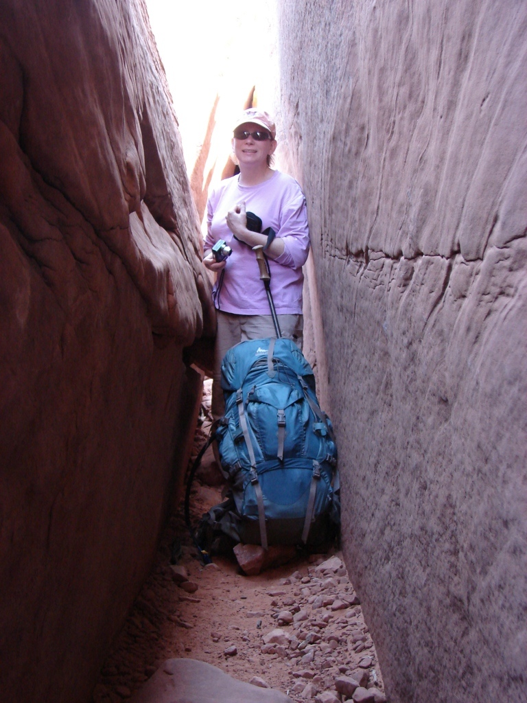
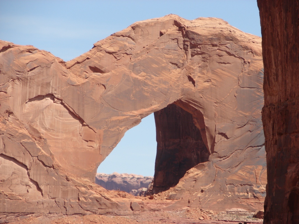
The weekend of 9 Apr 10, Tracy and I headed out to Coyote Gulch in the Grand Staircase-Escalante National Monument in southern Utah. We had once hiked down to the confluence of Hurricane Wash and Coyote Gulch, but we didn’t hike past the confluence. This time, however, I wanted to see the confluence of Coyote Gulch and the Escalante, as well as the arches and natural bridges in Coyote Gulch. So we drove to Escalante on Friday and stayed in a hotel Friday night. On Saturday we headed down the Hole in the Rock road to the Fortymile Ridge Road. I had read that the last couple of miles on the Fortymile Ridge Road had some deep sand, but I didn’t really think it was that bad. I was in 4 wheel drive, but I never really felt like the truck was having a hard time. It might be too much for a 2 wheel drive car, but it certainly wasn’t bad for 4 wheel drive. Once to the trailhead, we hiked across the desert to the Crack in the Rock. This was a slab of the cliff wall that had separated from the cliff which provides access off the desert floor down into the canyon. The view down into the canyon over the Escalante was outstanding. The Crack was too narrow to carry the full packs through, so we used some rope to lower them down. I was expecting the Crack to be more of a problem than it was, too. But with 40 feet of light rope to lower packs, the Crack is really no issue at all. After getting through the Crack, we descended a steep sand ridge down to the canyon and then we just hiked up-canyon in Coyote Gulch. The canyon was really nice, with some arches, a natural bridge, and some high walls. We didn’t see very many people, which was nice. We set up camp just past the natural bridge and had an uneventful night.
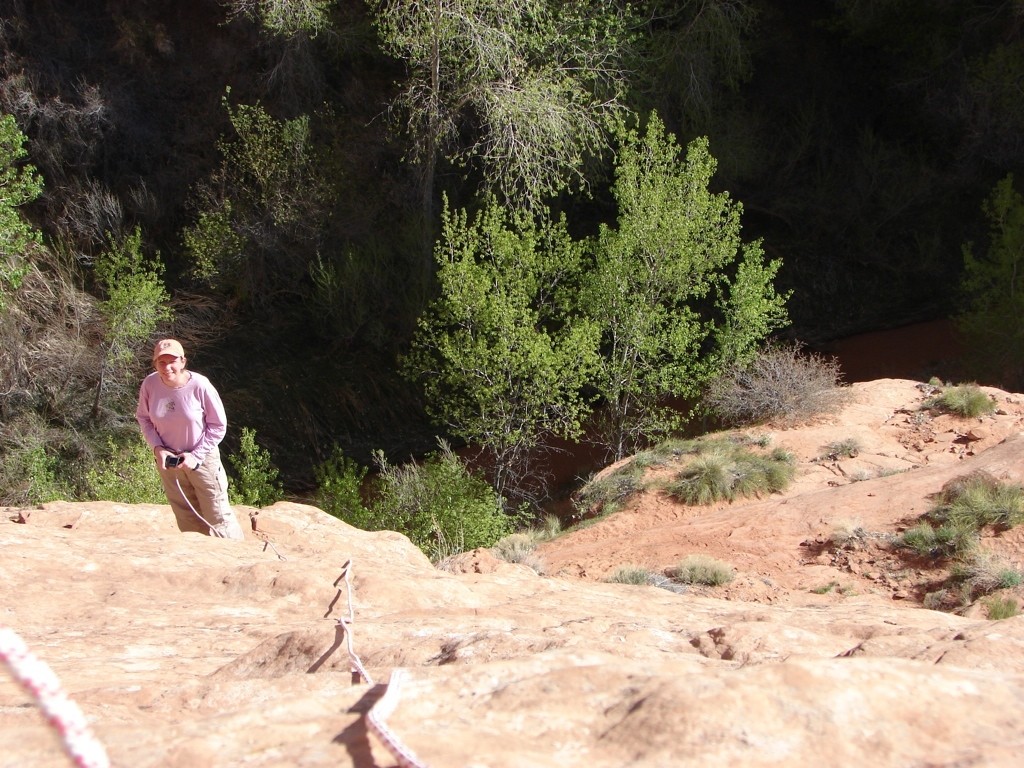
On Sunday, we hiked on to Jacob Hamblin Arch where there is an exit route from the canyon. This was the third and final obstacle that I was worried about it, and this one was far more difficult than the sand and Crack. We arrived at the exit just as a large group of 11 people arrived in front of us. They were slow and we had to wait on them. After about 20 minutes, we were finally able to at least start, even though the group was only about 1/3 of the way up. I didn’t have the confidence to try the steep climb while wearing my pack, so I free-climbed about 30 feet up and then dropped rope down to Tracy. Tracy then clipped the rope to the packs, and I hauled the packs up, and then I belayed Tracy as she climbed up. We repeated this process 4 or 5 times until we were able to free climb the rest of the way up. Of course, we still had to wait several times on the group so it took over an hour for us to get up. The climb was rough, but it could be done by an experienced climber while still wearing a pack, but I just didn’t trust my balance on the steep slickrock wall with the pack pulling me backwards. The only drawback to the way we did it: we ripped a couple of holes in each of our packs. We ended up having to take them to REI to get repaired, so that was kind of bad. The climb wasn’t really all that dangerous, but I would certainly think people with a fear of heights or who are really timid on exposed rock would have a tough time with this exit. But I thought it was fun! After climbing out, we headed back to the Tanks trailhead where I left my pack with Tracy and headed the two miles back to the truck.
This was a really nice canyon, and I really liked it. Tracy wasn’t a big fan of the exit climb, though, and it might be too much for people completely unfamiliar with climbing and slickrock.


loading map - please wait...