The Beartooth Plateau along the Wyoming and Montana state line is a bucket list trip. We had backpacked up here a few times, but we hadn’t spent as much time as I wanted to spend. So, for our 2016 Rocky Mountain trip we headed out for several days in the Beartooths.
The plan changed several times before we actually hit the trail. I originally wanted to start at Island Lake and then head north cross country towards the Continental Divide from Jasper Lake, and continuing all the way to Skytop Basin and exiting at Clarks Fork. I planned to do this trip in six days. As the trip neared, I realized this was overly-ambitious for the amount of cross-country walking I had planned…six days wasn’t nearly enough time for that amount of off-trail hiking. Moreover, I was worried that the off-trail portions would be impassable because I just couldn’t find any information about the route.
So, I changed the plan the week before the trip and decided to do a big loop starting at Island Lake, hiking to Kidney Lake where we would go off-trail to Jasper Lake, and then back to Island Lake. I planned to do this trip in four days, and then head over to the other side of the Plateau and do a three day trip up to Skytop Basin from Lady of the Lake.
One of the reasons I wanted to do this trip in 2016 was because we had done the Winds in 2015 and I wanted to compare the two and decide once and for all which range I like better.
So, we hit the trail and enjoyed the majesty of the Beartooth Plateau.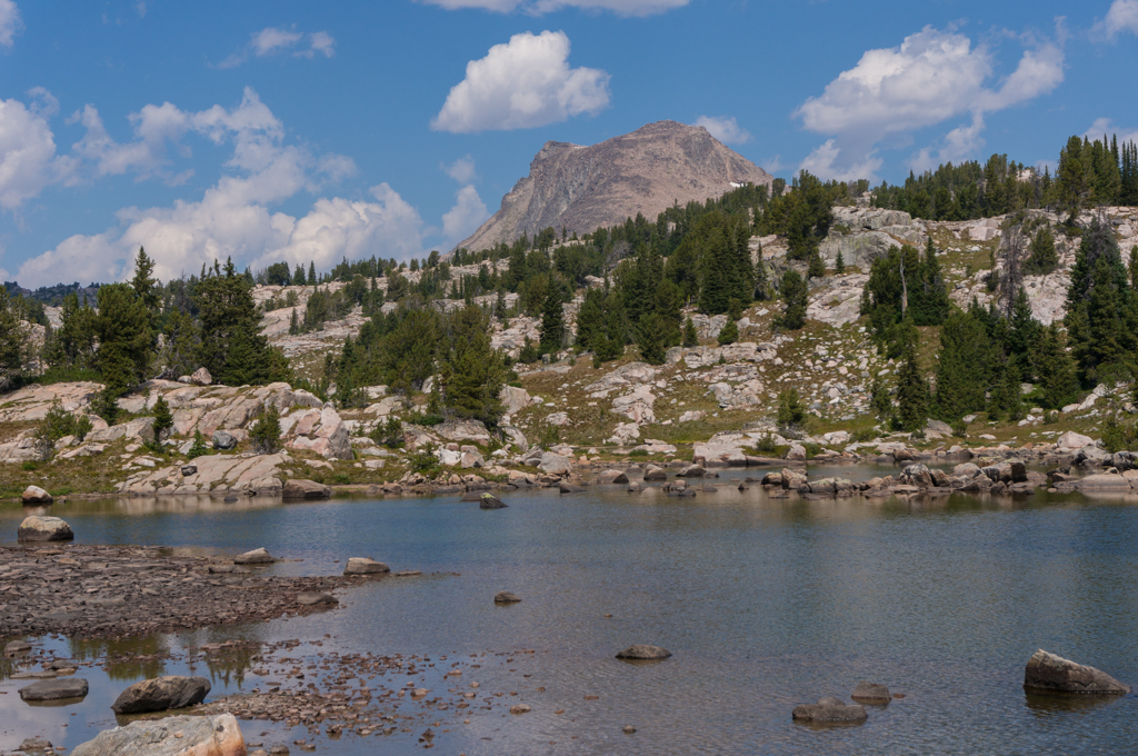
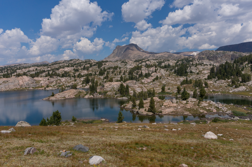
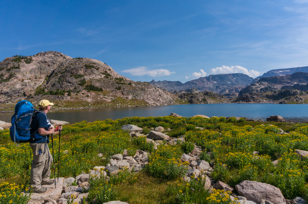
The first day was beautiful, with great lakes and lots of wonderful views. We camped at a lake just past Native Lake, and had the unnamed lake totally to ourselves. It stormed on us for a few minutes after we got into camp, but otherwise the weather was great. The only drama we had the first day was from a couple that was dayhiking. We were stopped near Native Lake, and they came up to us, walking further into the wilderness. As they approached, they asked which way they needed to go to get back to the trailhead. I asked which trailhead, and they didn’t really know that there were multiple trailheads. Therefore, I assumed they had started at the closest trailhead at Beartooth Lake, so I told them to turn around and then turn right on the trail down to Beartooth Lake. They thanked us and turned around to head back; I noticed that they didn’t have much equipment with them. A few minutes after they had left, I realized that I didn’t mention to them that they would pass the intersection of the Clay Butte trail before they got to the Beartooth Lake trail intersection, so I got worried they might take the wrong turn. I never heard about anyone getting lost out there, so I hope they made it back okay. The intersections were signed, though, and the Clay Butte trail leads out of the wilderness, so I’m sure they would have been fine either way. If they had kept going the way they were going when we saw them, they would have kept going deeper into the wilderness, and it was already just about 3 hours before sunset. That was a little scary.
 Day two was a surprise. I spend a LOT of time hunched over topo maps when planning a trip, but I always seem to miss certain things because of assumptions I make about an area. On this hike, I assumed that since we were starting and ending on top of the Plateau, then we would be staying on top of the Plateau for the entire hike. Day two showed me my mistake. After a mile or so past Native Lake, the Beartooth Highlakes Trail began steep descents…it wasn’t until we had dropped about 600 feet in about a mile that we realized we had dropped off the Plateau. Of course, we had to re-ascend that 600 feet, so that was fun. The trail literally dropped 600 feet in a mile and then immediately climbed the 600 feet back up in a mile. It doesn’t sound that bad, but it was very steep and unpleasant. We didn’t see anyone all day, and most of the trail wasn’t even that interesting, so now we know why most people don’t hike this section of trail. It was really pretty above Kidney Lake, though, and the view from Kidney made it all worth the effort. And even though we had only hiked about four miles, Kidney Lake was so pretty that we decided to stop there for the night. I hiked around for a few miles to check out the area, and we just enjoyed the solitude and the views.
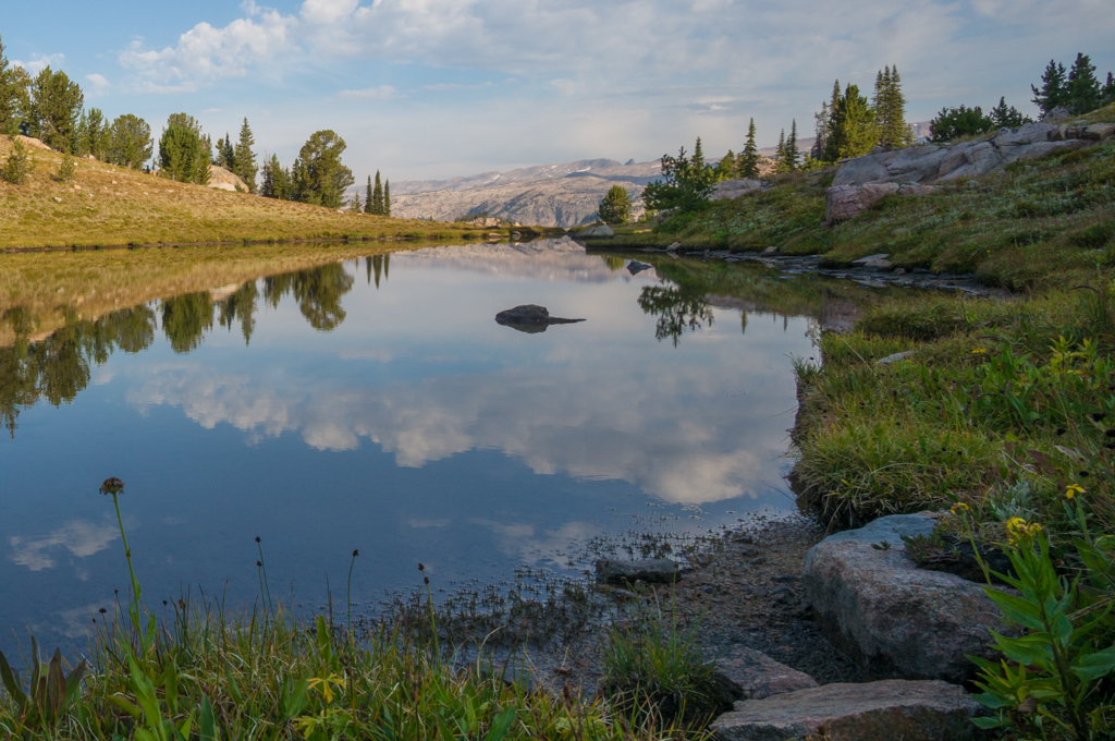
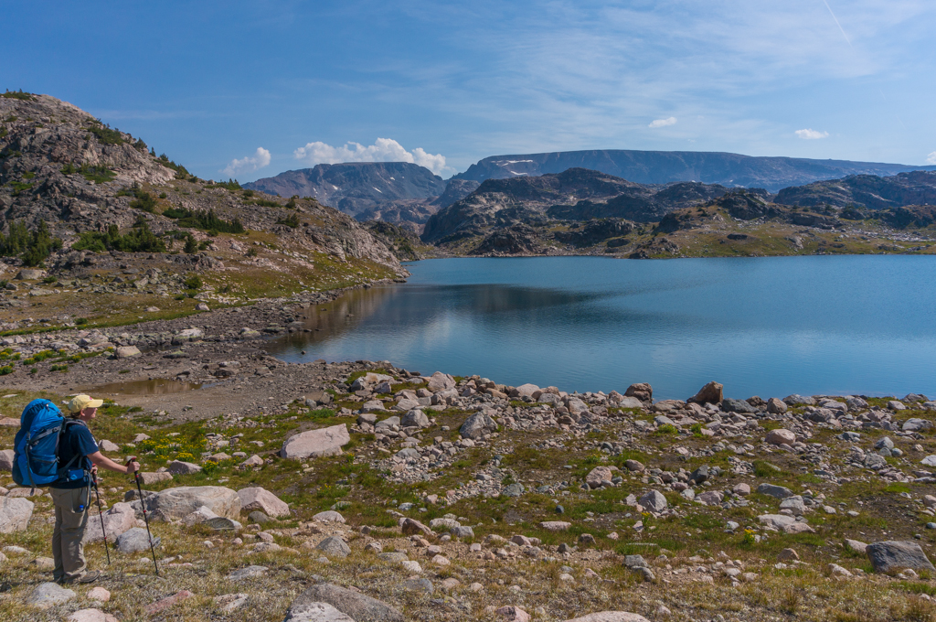
 On day three we headed cross country. This was the best part of the trip. We basically cut from Kidney Lake to Jasper Lake via Clover Leaf Lakes. The views were amazing since we were close to the Divide, and the lakes were amazing. We had a little adventure above Liver Lake, though. I saw that the obvious route descended down to the lake and then immediately regained the lost elevation via a boulder field. I had a bright idea to try to walk the ridge and avoid the descent and re-ascent. Unfortunately, we got cliffed out near the boulder field. Rather than backtrack for a mile and do it the right way, I found a couloir break in the cliff, and we slid down a scree slope to the boulder field. Once at the bottom of the couloir, we hopped across the boulders and made it to the saddle between Liver and Rachel Lakes. It was pretty sketchy, and I was worried about one of us falling and breaking our neck, but we survived with nothing more than frayed nerves.
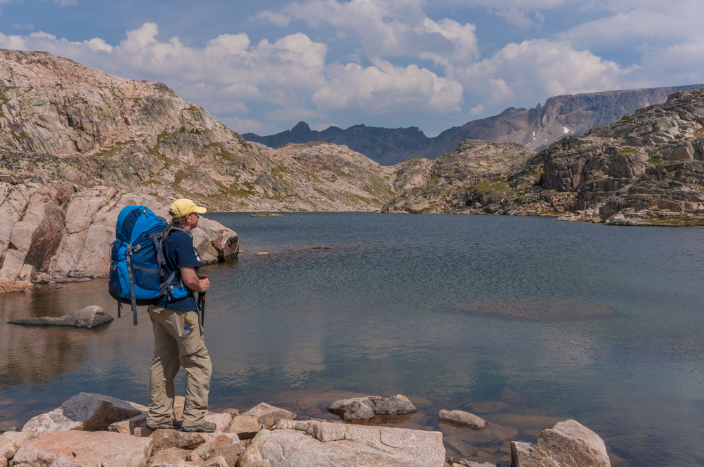
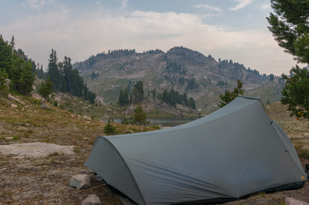
The rest of the day was incredible, and it was certainly the highlight of the trip. Simply hiking off-trail and enjoying the solitude and remoteness of the Montana Rockies is an inspirational experience. We pressed on this day, descending down to Jasper Lake and on to Becker Lake. On the saddle between Jasper and Albino Lakes, we ran into a solo hiker who was returning from a long trip into the backcountry. We talked a lot with him, and learned that he had basically done parts of the cross country hike that I had originally planned but had chickened out of trying. He confirmed that the route was doable as long as you find the right route. We pulled out the map and he showed me the tricks for the route. So, yeah, now I’ve got to go back and try this route! After talking to him for awhile, we continued down the trail and camped on the state line above Becker Lake.
 The next day was just a few miles down the trail and back out to the car at Island Lake. After the hike, we drove into Cooke City and filled up on hamburgers and ice cream. I love Cooke City.
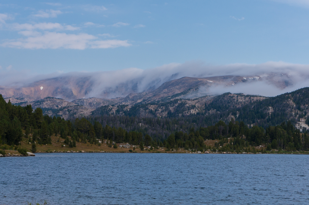
We had planned to head back out the next day for three days to Skytop Basin. Unfortunately, Tracy’s feet were pretty beat up and she was hurting, so we decided to scrap that part of the trip and just do some exploring on the north end of the wilderness. We had never been to the north end of the Beartooth-Absaroka Wilderness, so this was a good chance to check it out.
This was a phenomenal trip. We saw very few people, and the views were amazing. Hiking down and back up the Plateau wasn’t very fun, but it wasn’t too bad, either. Our pack weights were great…with food and water, we both started right at 29 pounds. I felt really good on this hike despite jacking my back up really bad just a few days before we left on this trip. I didn’t have any back problems and my feet held up great.
So, what did I conclude on my comparison between the Winds and the Beartooths? Honestly, it’s too close to call. I think the Winds are overall prettier because there are more alpine areas. But the Beartooths are much less crowded and almost as pretty as the Winds. And the Beartooths usually have less mosquitoes. I think it’s too close to call…they are both amazing mountain ranges. And another huge thing I learned: both ranges need much more than a single week to really appreciate. If you plan a week-long trip here, expect to want to come back and do more. They really are that good.
Photos


[mapsmarker marker=”79″]