This trip was outstanding. Norway is incredible. I would easily rank the parts of Norway we saw on par with New Zealand…and that’s a huge comparison.
I had to work for much of August 2018, so we were limited to travel in July and September. We opted to go to Montana in July for a backpacking trip, and we decided to visit Norway for an international trip in September. I expected the weather to be too cold by then for enjoyable backpacking, so I planned a bunch of dayhikes and hotel stays for a week and a half trip.
We left after work on August 30th and drove to Nashville. On the morning of the 31st, we flew from Nashville to Newark, and then we connected straight to Oslo. We arrived in Oslo on the morning of September 1st, picked up our rental car, and headed west.
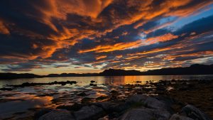
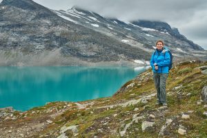 We had a crazy long five hour drive to a cabin at Tyinholmen on the edge of Jotunheiman National Park. I knew this drive would be terrible because it was long and I would be tired. It was terrible. The roads in Norway are often pretty narrow, and the speed limit was just over 50 MPH the whole way, so it seemed to take forever to drive to Tyinholmen. But we only had to stop and take a nap once. The drive to the cabin didn’t look very spectacular. It was pretty, but it just wasn’t anything outstanding. But when we turned off the paved road to get to Tyinholmen, the view of Jotunheiman just opened up…and it was incredible. We arrived at the cabins where we were staying near Eidsbugarden, and the views were outstanding. The cabin was also really nice.
I knew these cabins were in the middle of nowhere, and I intended to buy groceries on our way in, but in my fatigue, I totally forgot to buy groceries. So we had to eat at the cabin restaurant. We had a nice meal of reindeer, but it cost about $120…we think that might have been the most expensive meal we’ve ever had. We walked around a little, but passed out about 7:30.
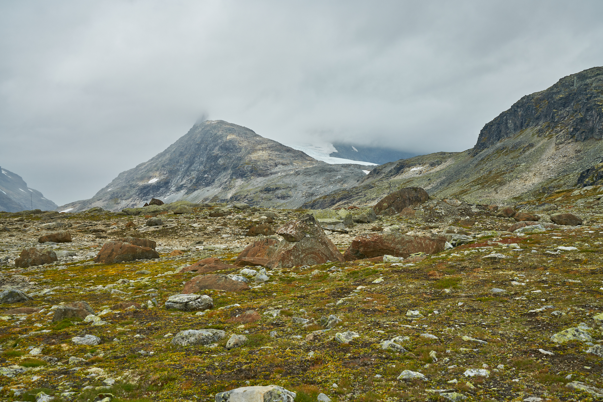
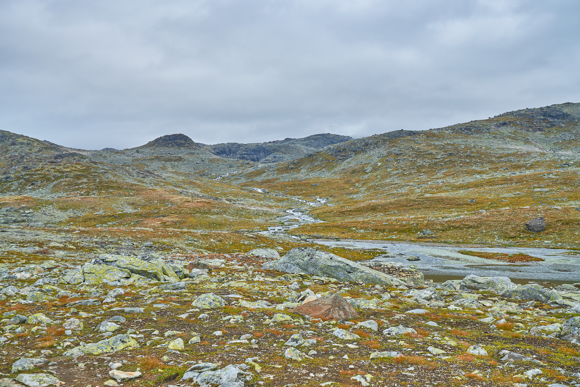
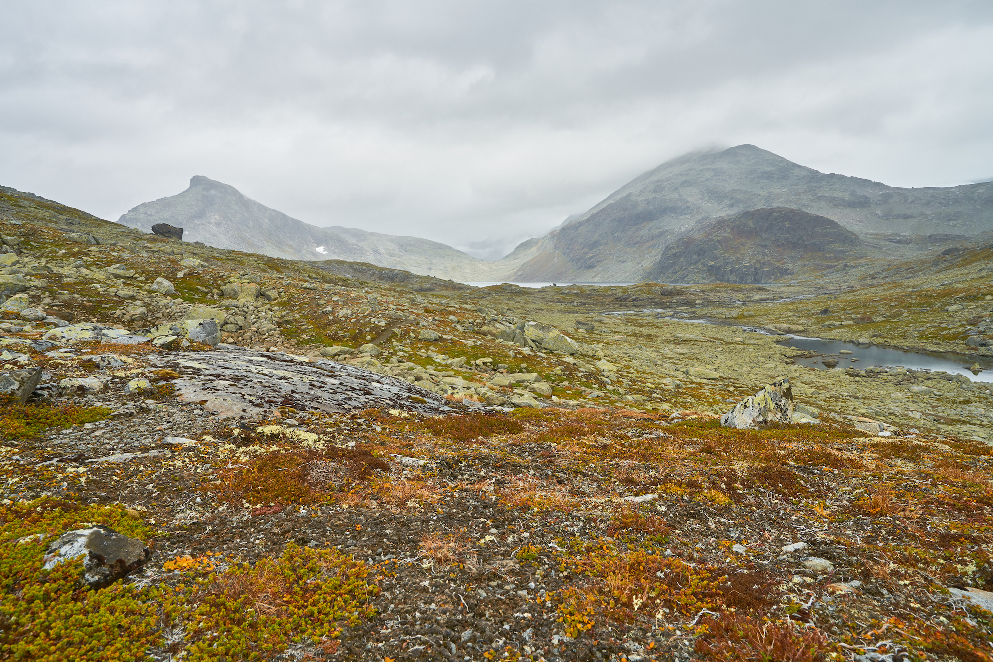
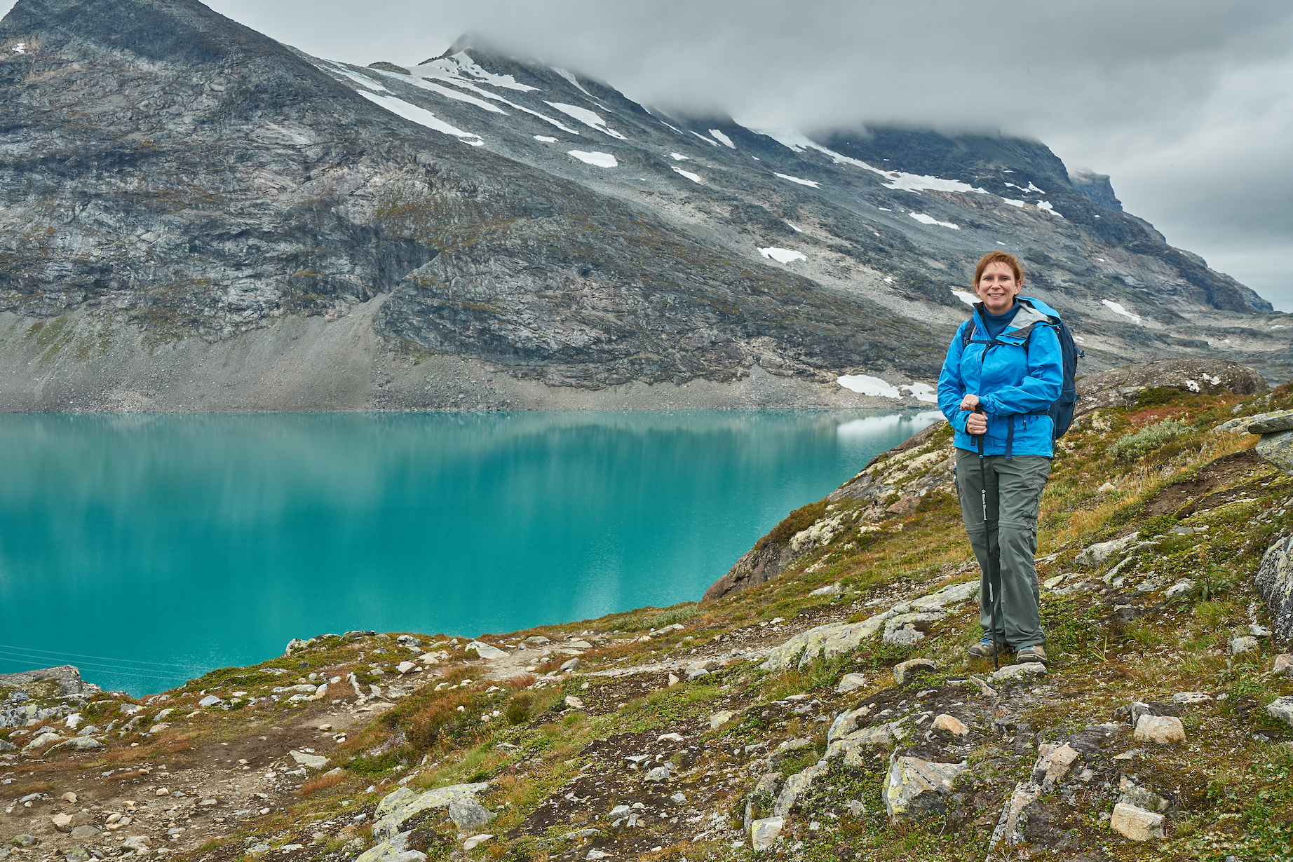
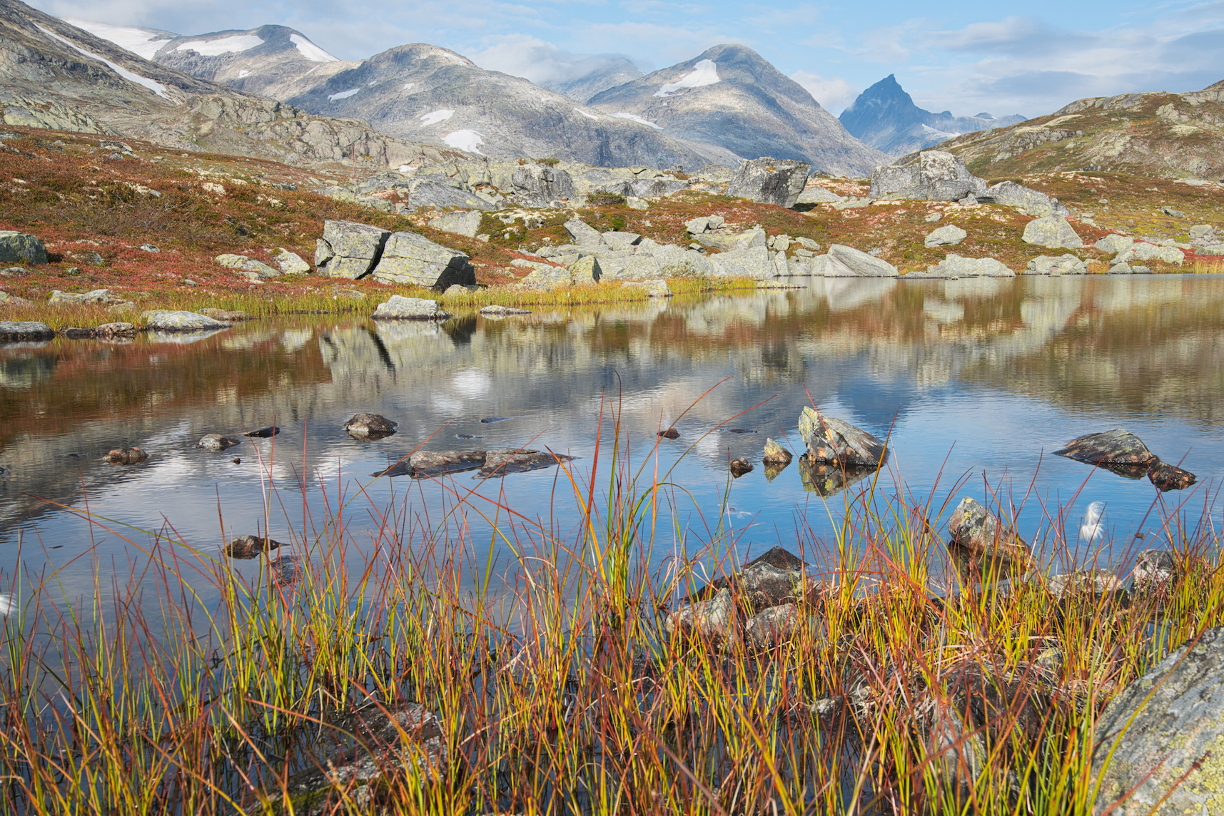
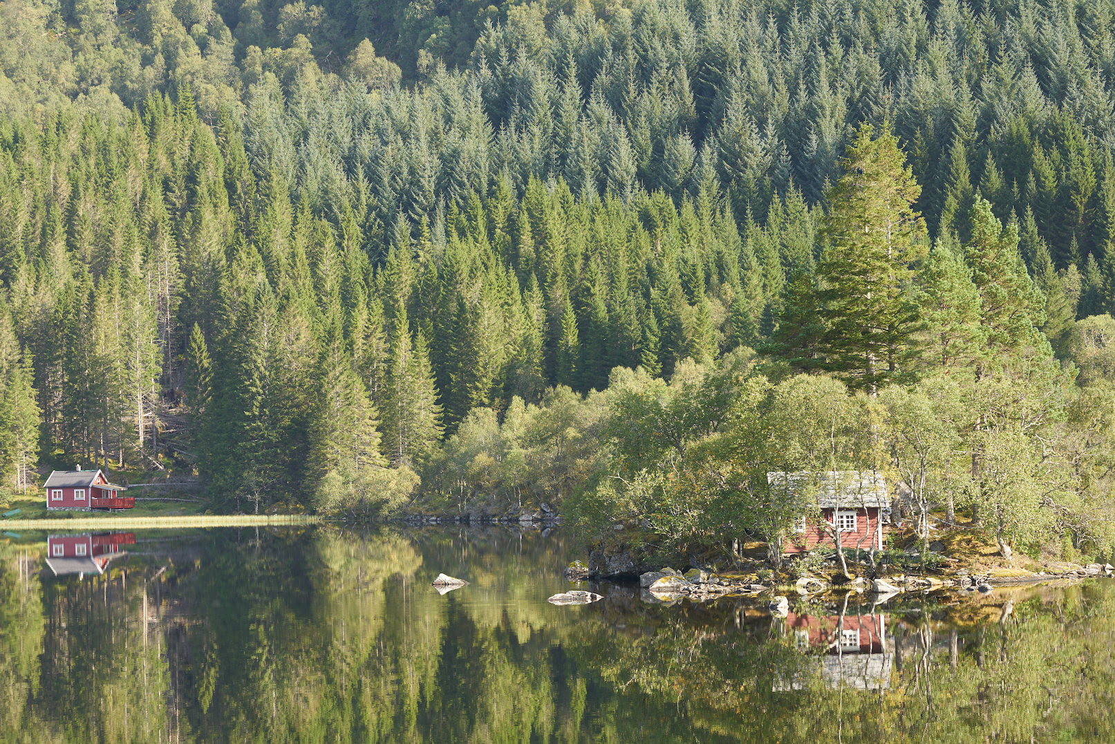
 We got up the next morning and headed out. We drove to Eidsbugarden to look around, and then we headed back into town to buy groceries. We needed snacks and water before we could hike, and we really needed food for meals so we wouldn’t have to eat at the restaurant. After getting groceries and gas, we drove back to Tyinholmen and went hiking towards lake Uradalsvatnet. I wanted to get a good look of the glacier above the lake, but the clouds were really low, so we couldn’t see the glacier well. But we did get some great views of a waterfall and bright blue glacier silt lake. The area was very pretty, and we only saw one other hiker. There were no trees, the trail was well-marked, and we had a great afternoon.
After hiking, we returned back to the cabin, had dinner, and passed out early again. I was awakened about 8:30 by a helicopter, but I quickly went back to sleep.
We got up the next morning and learned that the helicopter had been flying around because someone had fallen at the glacier we had been trying to see the day before and had died. That was sad. We continued on to Eidsbugarden, had a hard time figuring out how to use the pay station to pay for parking, but soon got started on our hike.
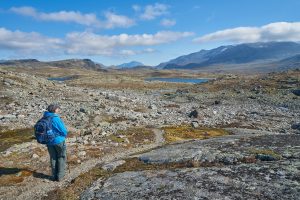
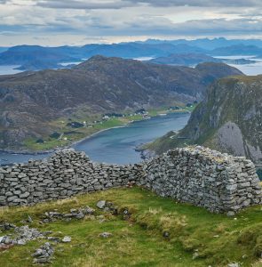
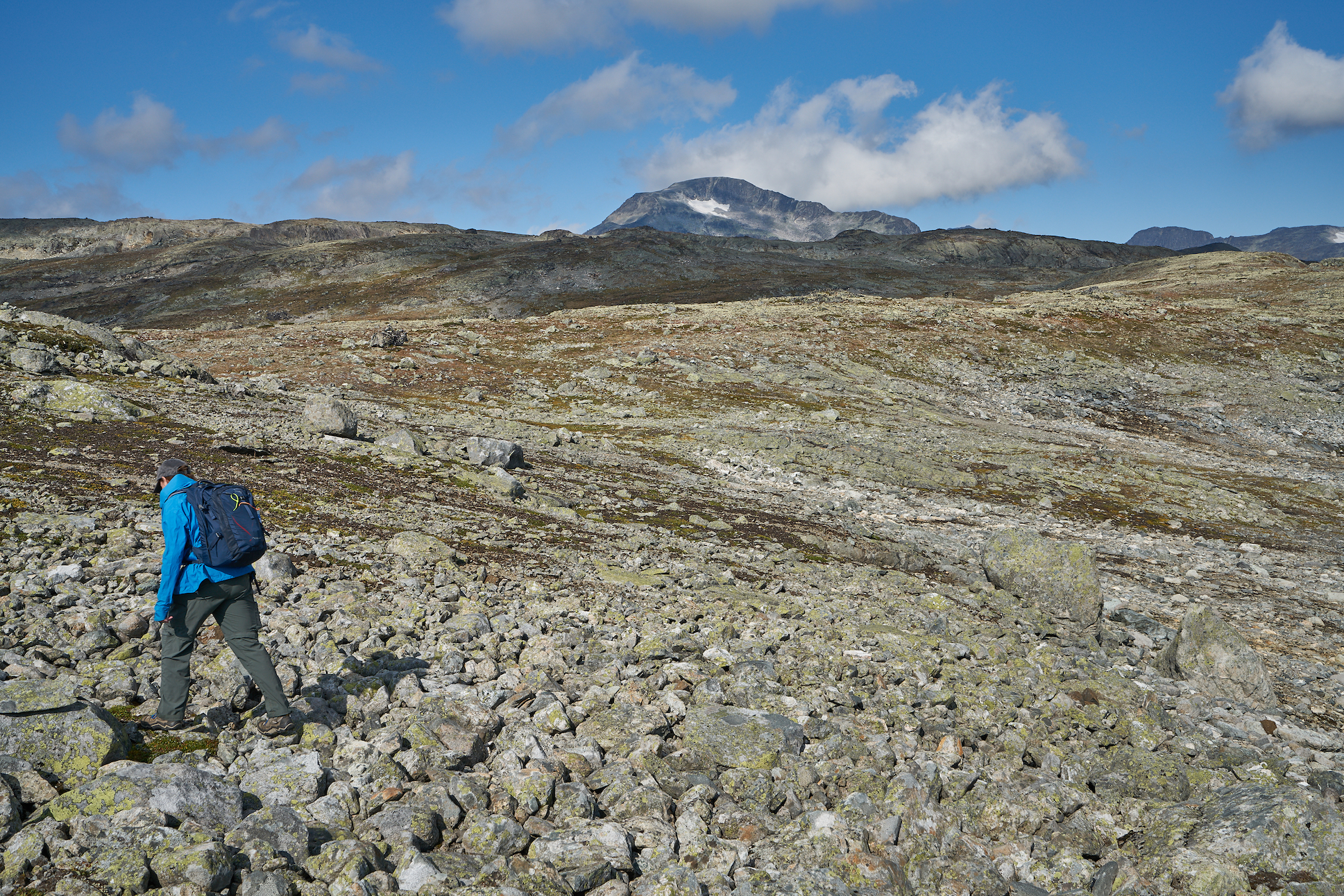
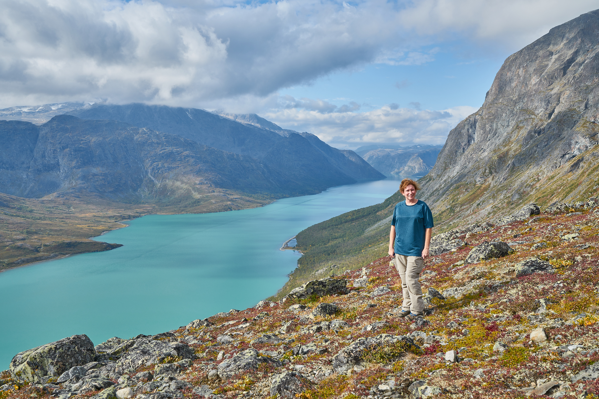
 We started along Bygdin lake, and then turned to climb steeply above the lake on lightly-used trail that headed into the park. This trail was incredible. We got awesome views over Bygdin and Eidsbugarden, and as we continued further into the valley, we got amazing views of the surrounding mountains. It was quiet up there, and the views were incredible. We saw one family from a distance that had camped out, but we didn’t see anyone else at all. This was a great hike, and just spent the day enjoying the solitude and views.
Eventually, we backtracked down the steep trail back to the trailhead and then headed back to the cabin for the night.
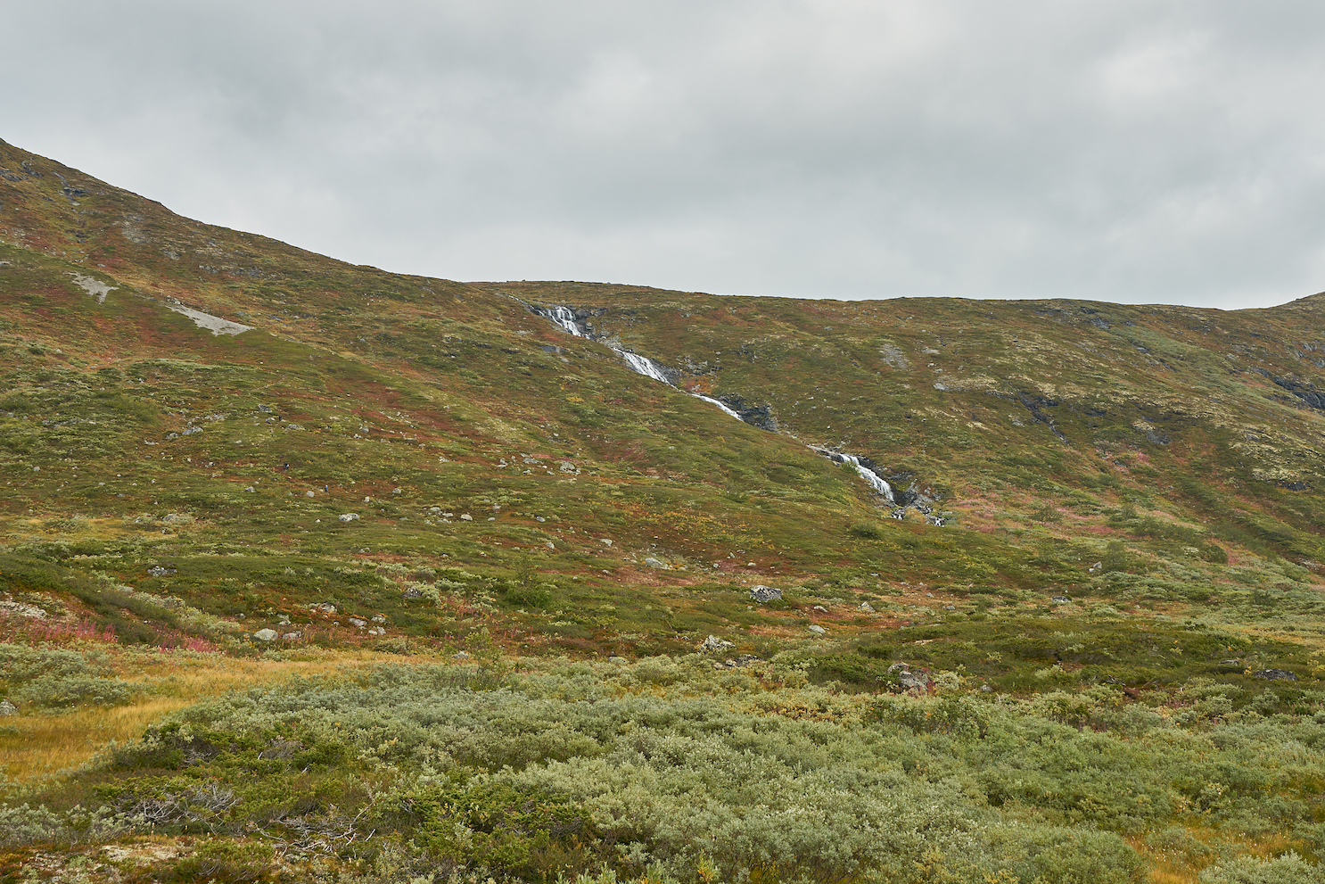
After three nights in the cabin, we got up the next morning, cleaned up, and checked out. We drove just a short distance and hiked a trail that went south near lake Tyin. This was another great trail with outstanding views, but it was flatter and easier than the trail the day before. After lunch, we headed back to the car and began the drive to Bessheim. We tried some shortcuts to get to Bessheim, but they were closed, so we ended up taking the long way to get there. We drove through some very pretty areas, and saw some caribou once we got up high on the road. This drive was super pretty, and we really enjoyed it. We made our way to our hotel in Bessheim, checked out the trailhead where we planned to hike the next day, had dinner at the hotel since it was included in the price, and called it a night.
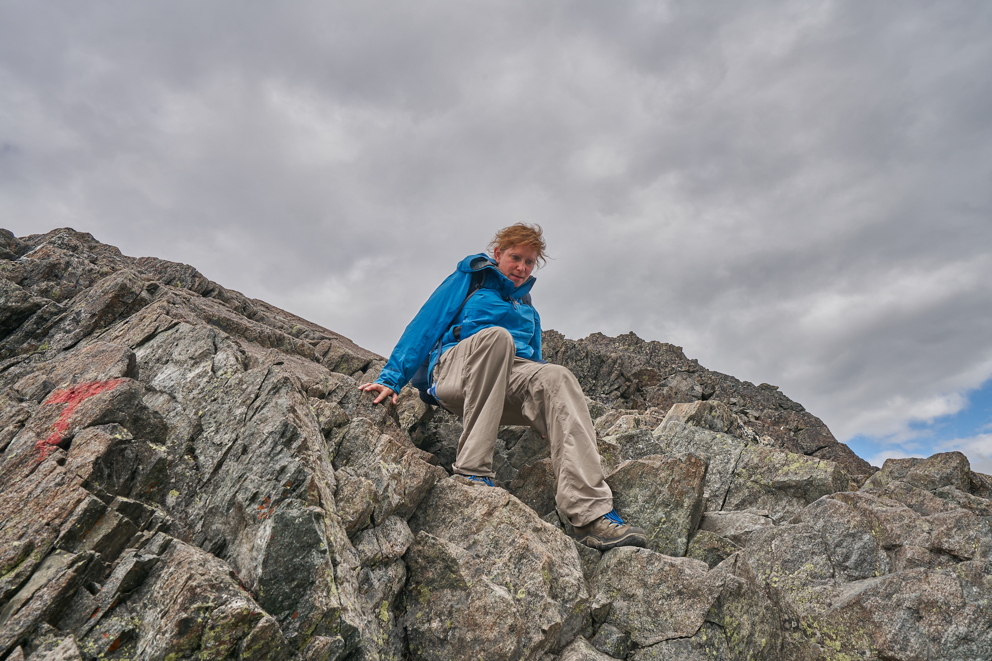
We got up the next day and headed to the trailhead to hike the popular Bessegen Ridge. This is a very popular trail in Norway, but this was the shoulder season, so the trail wasn’t very crowded.
 And it earned its reputation. This was an absolutely beautiful hike. Some people take the boat to Memurubu and then day hike back to the trailhead. We started from the trailhead with a reservation at the hut at Memurubu for the night. We each carried our daypacks with rain gear, food, water, camera gear, and a change of clothes. The trail quickly climbs steeply from the lake, and has one section with a bit of exposure and a chain to use as a handline. The exposure wasn’t anything significant at all, but someone with a fear of heights might not enjoy it very much.
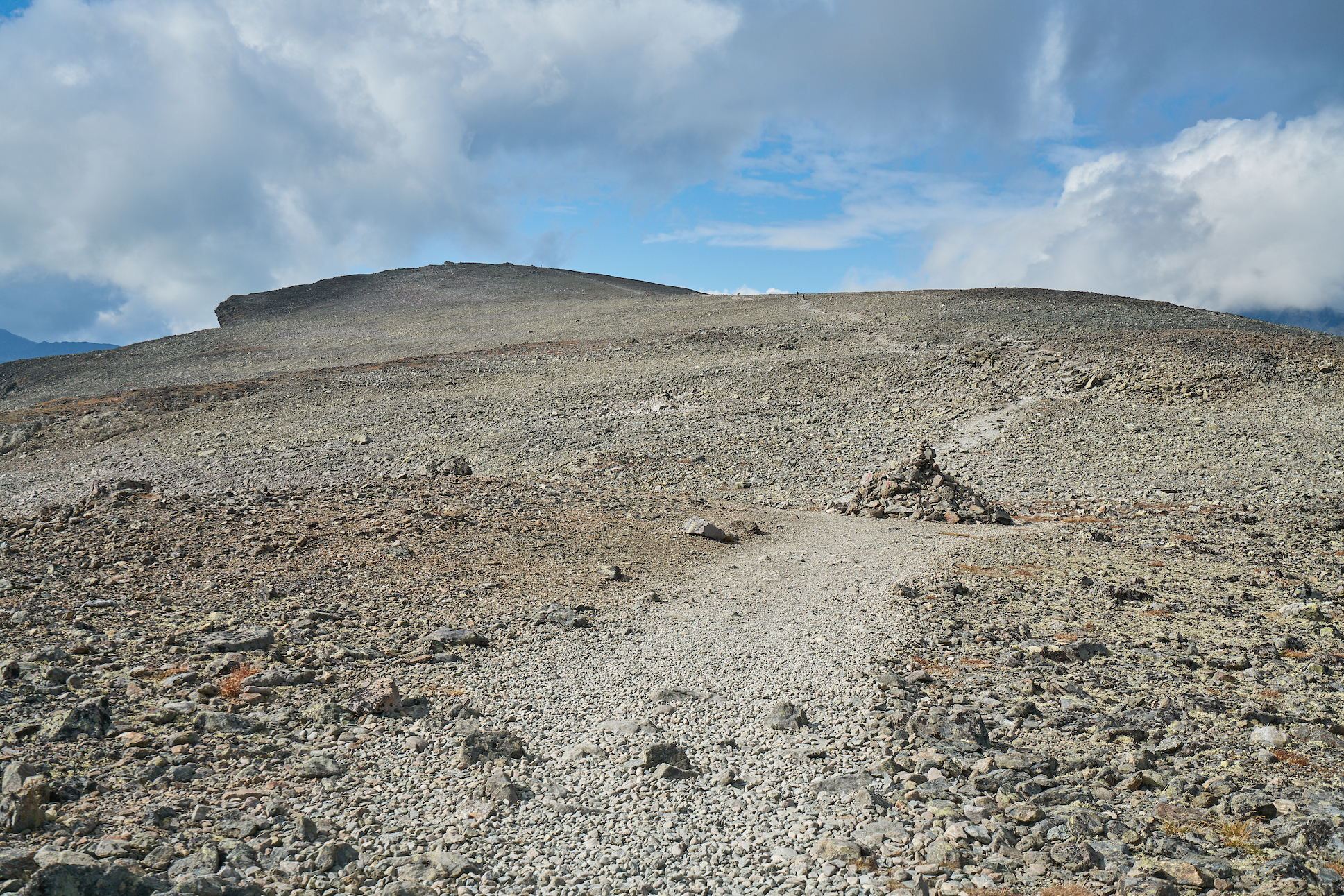
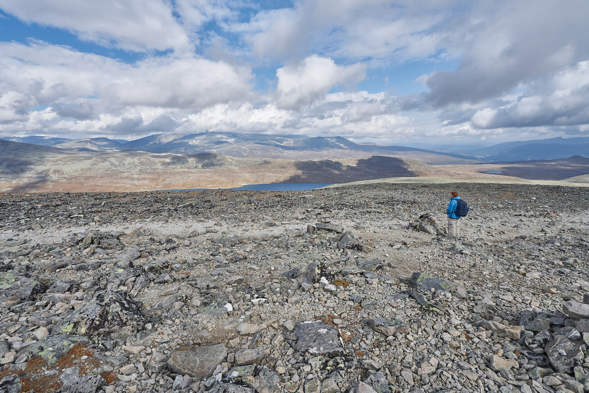
Once on top of the ridge, it was like being on the moon as the mountain is completely covered in rocks, with no trees and virtually no other vegetation. The trail is very well maintained and easy to follow as it traverses the top of the ridge. The wind started blowing pretty good while we were up there, and it got a little chilly, but it was really pretty.
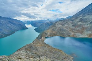
After passing the high point of the ridge, we started passing more people. We heard a few Americans passing us, so we asked them about the trail ahead. We were told that it was really steep and a little scary, but we just thought they were describing the same kind of thing we had experienced coming up the mountain. But then we got to the end of the ridge. And it dropped…quickly. It descended over 1200 feet in just over a mile…but it did most of that descent over a convoluted ridge of exposed rock that required sitting and scrambling down the mountain. We hit the bubble of dayhikers coming from Memurubu on this descent, and some of them seemed a little spooked by the ascent they were doing.
 But it wasn’t bad at all. The guys behind us descended it with full backpacks using hiking poles without sitting down at all. I wouldn’t recommend doing it that way, but they did it. I was glad we got down it before the rain started a little while later, but it wasn’t bad. I was surprised to learn that they have very few injuries on that hike, though, because it was sketchy enough that I could imagine people falling and breaking an ankle or something. But the view from that spot was amazing, and it made the entire hike worth it.
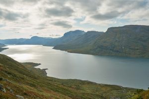
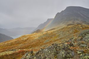
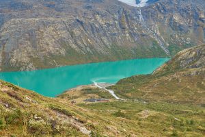
After that descent, we had the trail to ourselves, and that was wonderful. It rained some, but that just meant we got a rainbow and some nice clouds. The hike past the ridge was probably my favorite part of the trail, as it was less crowded and it was very pretty, with views of glaciers, the beautiful Gjende lake with its glacial silt blue-green color, and the valley at Memurubu. It was just really pretty.
Then we made the steep descent down to Memurubu as it started to rain again, and we found our way to the hut. We checked in, got to our room, and then went to dinner at the hut. The dinner was included, and was a very good meal. There were only four other groups at the hut, and we talked to some of the other people, and that was nice. Then we got a good night of sleep in a hut in the Norwegian backcountry.
 We got up the next morning, got a shower, and then caught the boat back to the trailhead. The hike the day before had taken about eight hours…the boat ride back took 15 minutes. But believe them when they say the eight miles will require eight hours…the trail is just that slow to hike.
Once back at the car, it was raining, so we started the drive to the fjord at Geiranger. The drive was nice, and then it was a steep road from the glaciers in the mountains down to sea level at Geiranger.
Geiranger was a nice town. It’s a cruise ship port, and I imagine it would be a terrible place to be when a ship was there, but it was a small town on the water, and it wasn’t crowded at all. We spent the evening walking around town, and just enjoyed watching all of the star fish and jelly fish in the fjord. The fjord was pretty, but it really wasn’t as pretty as the huge lakes we had seen in Jotunheiman with their blue-green color and fjord-like mountains. We were glad we saw the head of a fjord, but the sides were so steep that there really isn’t any hiking in the area.
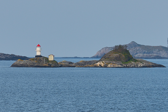
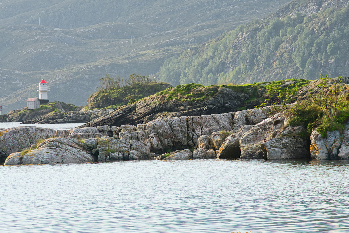
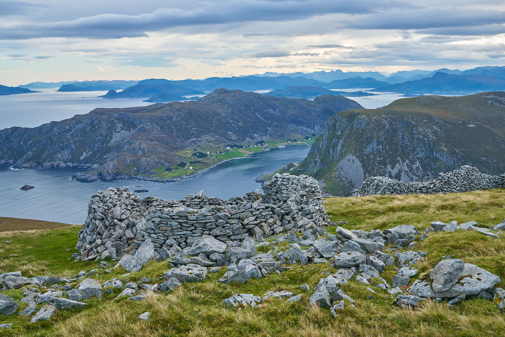
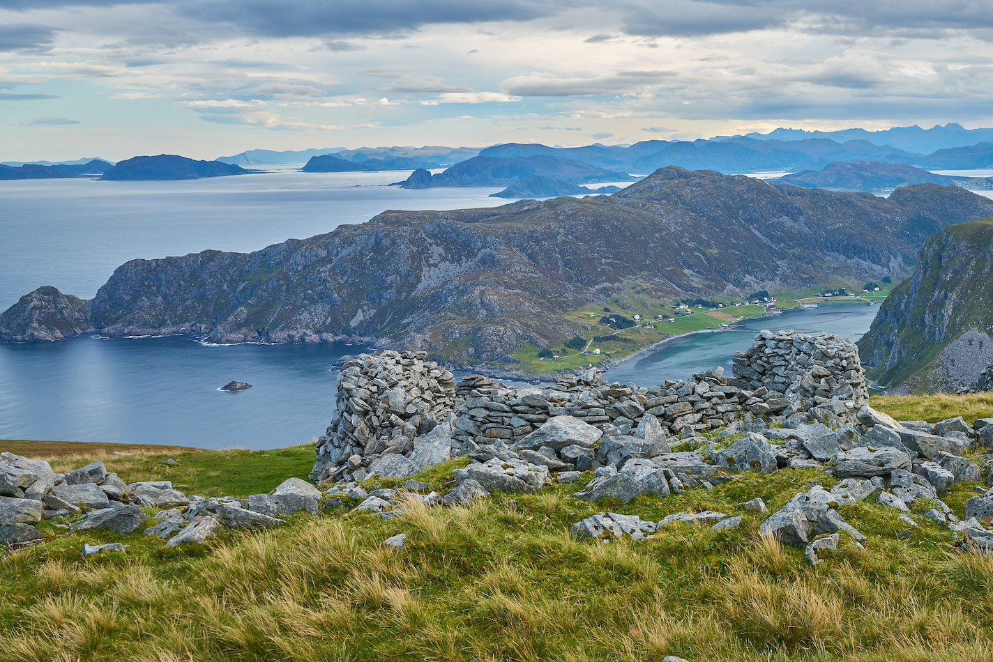
So we got up the next morning and drove up the opposite side of the fjord for some photos, and then turned around and started our drive to the coast at Måløy. This drive involved driving through 14 tunnels…some of which were four miles long. That was pretty cool. And eventually we made it to Måløy. This town seemed a bit industrial for our taste. I had picked it for a night because there were some lighthouses nearby that I thought it would be nice to see. So we drove outside of town on some absurdly narrow roads to a trailhead for one of the lighthouses. We drove past the trail to a small beach, then went back to the trail. We parked on the side of the road and headed out. The beginning of the trail was on a driveway, but when it reached the end of the driveway and became a trail, it became steep and muddy. We hiked for awhile, with no views of anything, when we realized the trail was going to descend and then re-ascend while following power lines through muddy bogs. This didn’t look fun. So we decided to stop the hike for the day, and we hiked a little off the trail to a great overlook of the Norwegian Sea. It was really nice, and we just sat there and enjoyed the view for awhile.
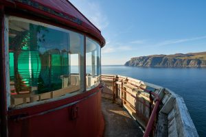 Then we hiked back to the car, and drove out to the other side of the island. This involved more crazy narrow roads, but we hiked a shorter trail to another lighthouse, and that was fun. The lighthouse was not a tall lighthouse like we’re used to seeing because it was up on a cliff face. This also made it hard to get any good photos, but we had nice views of the ocean, so that was good.
We then drove back into town and walked around looking for dinner. The town was really crowded and busy when we drove through at 3 pm…but it was a ghost town at 7 pm. We really only found one open restaurant, so we went there and got a pizza. The pizza was pretty good, though, and we had left-overs for lunch the next day. Then we went back to the hotel and called it a night.
The next day we got up early and drove back in the direction of the lighthouse we had seen the day before. This involved more really narrow roads, but we got some decent photos of a smaller lighthouse. Måløy was okay, but I felt like we could find a prettier coast somewhere. So we started driving north to Stadlandet, which is a peninsula just north of Måløy. We had reservations for two nights in Leikanger. I had picked this area because it had some trails near the coast, so I thought it would be worth checking out.
And I’m glad we did. It was really nice on that peninsula.
 After checking in to the hotel, which was right on the water, we drove out to the coast. I saw that there was a surfer beach, so we drove out to see that. When we got there, we didn’t see any waves. But we saw a bunch of surfers. They tried to catch little two-foot waves every so often, but they just went a few feet and fell down. It didn’t look like much fun. We walked around a bit and then headed back to the hotel because it was getting rainy and we were tired. After dinner at the hotel we walked around town for a bit until it started raining, and then we called it a night.
We got up before dawn the next day and headed north of town to try to get some good sunrise photos. The sunrise was slow to come, but when it did, it came with a bang. The sunrise was great and I got some decent photos, so that was great. I almost got stranded by the incoming tide, but Tracy kept me in check.
After sunrise we drove around some more and found some old World War II sites. I wondered why there weren’t any signs at the site, but after reading about it, I realized Norway was occupied by Germany very early in the war, so the battlements were German…and I can imagine the Norwegians didn’t want to memorialize that.
 After breakfast at the hotel we drove up to Vestkapp, which is a tall mountain on the coast. It has great views of the ocean and the mountains, with 360 degree vistas. It was windy up top, but the views were outstanding, so we spent some time wondering around up there.
After leaving Vestkapp, it rained some more, and later in the day we took a walk along a road on the south-west side of the peninsula. This was a dead-end road right along the coast, and it was a great way to spend the afternoon. It was just flat, open, pleasant walk, and we really enjoyed it.
After dinner we took another walk out of town, and really enjoyed the small town atmosphere as we walked along the coast.
 The next day was our long drive working our way back to Oslo. We drove back through all of the tunnels and eventually ended up on the only major highway we had driven. We came in north of Lillehammer, and stopped outside of Lillehammer for the night.
The next day we walked around some and drove to our hotel at the airport. And the next day we flew back with no drama.
This was an amazing trip. Norway ranks right up there with New Zealand for outdoor beauty. Jotunheiman was amazing, and I want to return and explore it more. I also want to explore further north in the country. I’ve read that the tourist places can get crowded in the summer, but in the shoulder season in the remote backcountry, it was great. Norwegians are nice, and most of them speak good English. We got a lot of mileage out of the Google Translate app, though, and I highly recommend that for shopping or signs. We loved it, and we were already planning our return trip before we had even left. That’s the mark of a great vacation.
You can read my trip journal at PolarSteps.


[mapsmarker marker=”205″]