The weekend of 7 Oct 11, we finally headed out to the Maze District of Canyonlands National Park. I had been wanting to do this area for a couple of years, but I was always scared by the stories of how bad the roads are…but I was drawn by the stories of how remote the area is. I had driven out to the Hans Flat ranger station not long after we moved here, and I tried driving past it, but I got scared of the road after just a mile or so past the ranger station…so I was really worried to drive 20 miles past the ranger station. But I summoned up my courage and got a permit for two nights in the Maze. I figured I might break my truck in half, but I wanted give it a shot.
 There are really only two ways into the Maze: from Hans Flat and from Hite. The Hans Flat road has a really steep switchback section, but the Hite road is further from home and a longer drive. But I was still worried about the steep switchback section of the Flint Trail, so I decided to drive in from Hite. We stayed Friday night in Green River, and then called in the next morning to get our permit. Actually, I think we got our permit over the phone the day before, but we kept checking with the ranger station because there had been rain for the past couple of days, and I was worried about the condition of the roads. The ranger said she thought the roads were okay, though, and she issued our permit over the phone. So we drove down to Hite, filled up on gas at the one pump station at Hite, and then headed into the wilderness.
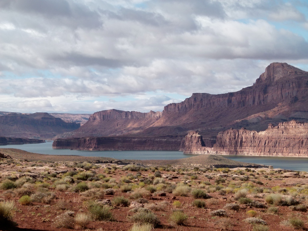
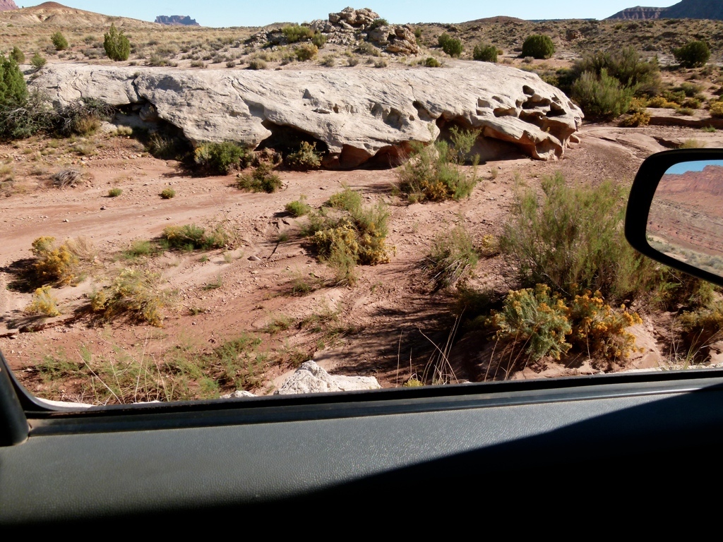
On the way, we saw that Lake Powell was much higher than we had ever seen it. I looked it up when we got back, and the water level is nearly 40 feet higher than the lowest we have seen it. That’s crazy higher. But the drive coming in at Orange Cliffs started out well. Tracy drove for the first couple of hours, because the road was dry and easy to drive on. I started driving after about 35 miles in around the road that turned off to the Doll House. The Doll House road gives the best access to the Maze, but that is the worst road in the Park, so I definitely didn’t have the guts to try it by myself for the first time. So we kept on going towards the Orange Cliffs. We passed the first and only other vehicle just before we started up on a bench of the Orange Cliffs…they looked happy and their truck looked clean, so we figured they hadn’t run into anything bad. But after about 20 minutes, the road climbed steeply up onto the bench, and I dropped it into 4 wheel drive for the first time…and it started raining. Once we got up onto the bench, it started raining more very quickly, just as we found the horrible bentonite clay. I drove up over a small hill where I slid all over the place, and then dropped down into a small low-lying area, where the road was completely clay. Looking about 30 yards up the road, I saw that the road swung out on the edge of a cliff for the first time on the drive, and the road still looked like clay. Not wanting to risk sliding off the side of a 1000 foot cliff, I stopped the truck to wait out the rain storm. Once I stopped, I put on my rain gear and walked on up the road, and decided that, yeah, I didn’t want to drive that in the rain. I walked about a mile up the road, and that whole mile was on the edge of the cliff and it was all clay. After a mile, the road moved away from the cliff, and it wasn’t as slick. It also stopped raining, so I started back to the truck. But about 15 minutes later, just as I was almost back at the truck, it started raining again…harder. By the time I got back to the truck, I was barely able to walk on the road because it was so slick. This wasn’t turning out good. Water was starting to run off the cliffs into waterfalls over the cliff. It wasn’t good. I started thinking that we may not be able to keep going forward, and we might have to turn around. So I walked back down the road from where we came. But that direction was even worse for 100 yards behind us. I didn’t think we would have any chance of getting back up the small hill we had just come back down. If we had stopped 100 yards earlier we would have been fine…but now it looked like we were stuck.
The rain stopped after about 30 minutes. By now we had been stopped for almost two hours. But after the rain stopped, the sky didn’t clear up, and the road wasn’t drying quickly. We sat there for about two more hours before I decided that it had dried enough to risk continuing the drive. So we just hung on and drove. The worst muddy spot was right by where we had stopped, but we got by without too much sliding toward the edge of the cliff. After that, we ran into three significant waterholes that we had to negotiate. One of those was in a precarious spot above the cliff, and one of them was long and deep. It took us nearly two hours to get through the mud holes, but we eventually made it to the Flint Trail, and the road was much drier. All in all, it took us 6 hours from the start of the rain to travel about a mile and a half.
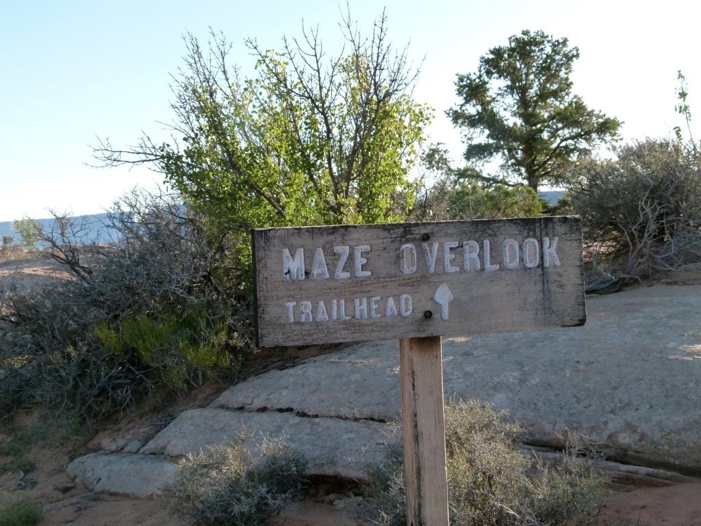
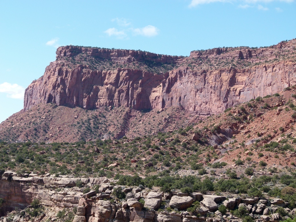
The driving became much easier for awhile, but soon we hit some tough rocks. Over the next few miles on the trail, we hit three spots that were the toughest rock crawling that I had ever done. My fear that I would break my truck resurfaced, but Tracy did a great job of guiding me…after she figured out what she needed to do…and we made it through without any big problems. But that took a long time to negotiate, also, and about two miles before the Overlook, we both decided we had had enough, and it was getting dark. So we stopped before the overlook to camp for the night. After dark, we walked about a mile up the road, just enjoying the moon and desert. The night went uneventfully, but we both decided that the road had worn us out, and we decided we just wanted to dayhike the Maze instead of backpacking it. We had literally only seen one car all day long, and that was at 10 am.
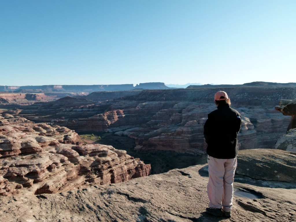
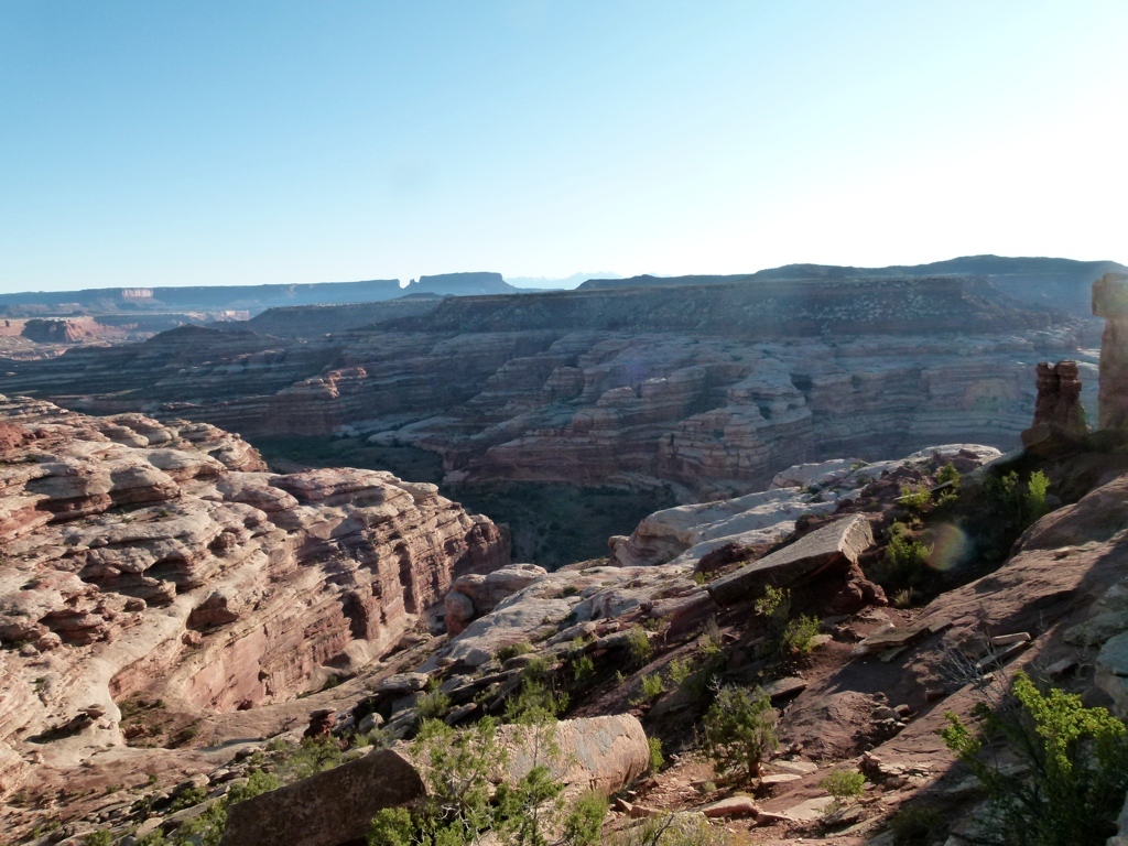
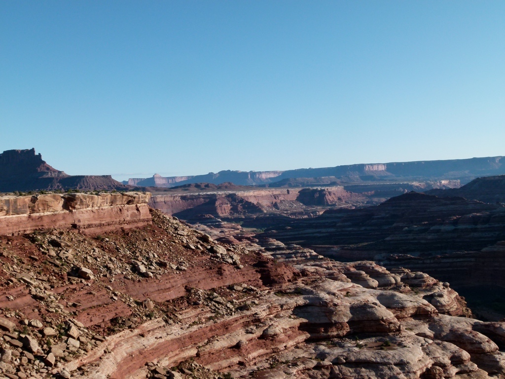
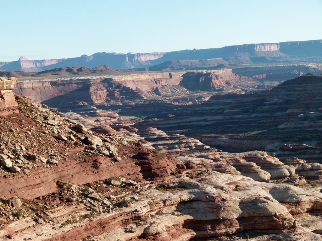
So, the next day we got up and drove to the Overlook. The Maze was really pretty, and I’m glad we drove out here. But we both kind of felt that it looked a lot like the Robber’s Roost area…and it was a LOT harder to get to. We stayed there for an hour looking at the steep trail climbing down into the Maze, and we decided that we just didn’t feel like dealing with it. The climb down looked tough, and we were still worried about the challenging drive out that we needed to do. I knew that I would be worried about the drive the whole time we were hiking, so I just wanted to get out to know if I could do it. The bad parts coming in were mostly downhill, so I knew they would be harder when going uphill, and I had such little experience with those kinds of obstacles that I just wanted to know for sure that we could make it. So, we left the Maze after about an hour and headed out. We ended up having absolutely no problems getting out whatsoever. We had both gotten better at negotiating the obstacles, and the road had dried out, so we made it out in just about 5 hours. We used about 1/2 a tank of gas, and only put 100 miles on the truck. But about 50 of those miles were in 4 wheel drive, and the 100 miles took almost 16 hours to drive!
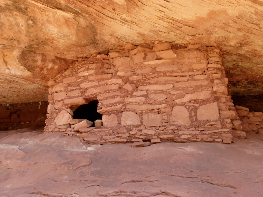
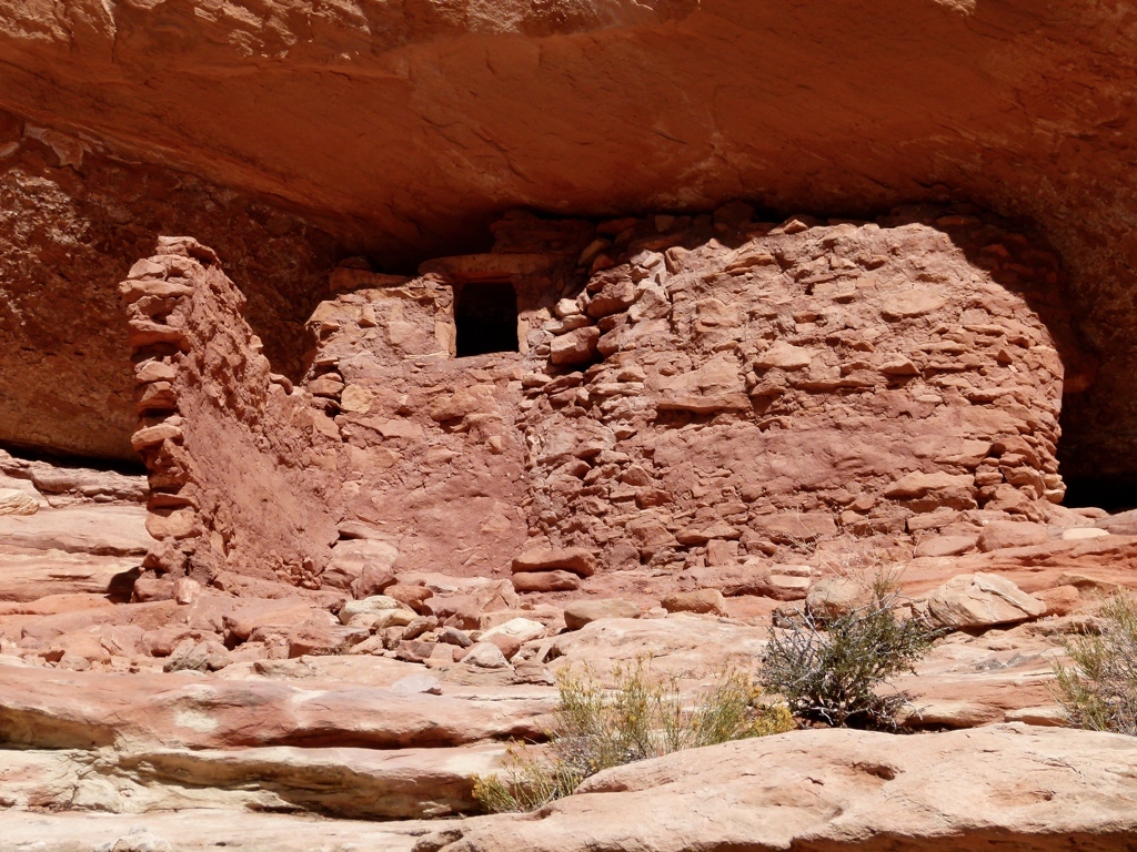
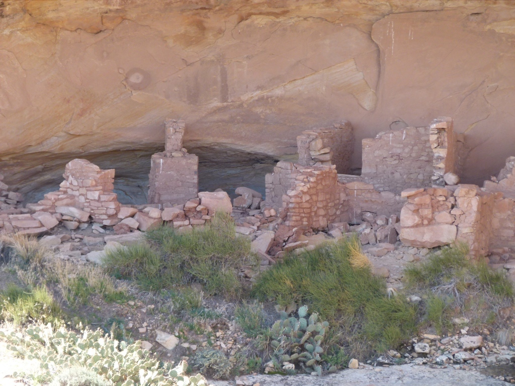
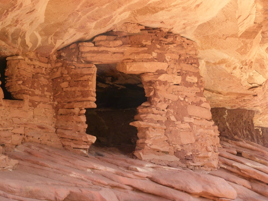 But we went back to Hite to get some gas, and then we headed towards Cedar Mesa. We walked a little around the lake near Hite, but then continued towards Cedar Mesa. I wanted to check out some of the ruins on Cedar Mesa, but when we got down there, I remembered why we never hike out here: the BLM charges to park at every single trailhead anywhere near the Mesa. It’s really very frustrating. We checked out a couple of trails, but I wasn’t sure if our Parks pass was accepted at the trailheads, so we just kept driving. We ended up going down the Moki Dugway, and then we drove into Bluff. I wanted to stay in Bluff, so we found a room there. I wanted to walk around, but the Maze had just worn us out, so we ended up crashing right after dinner. The next day, Monday, was a holiday, and we were scheduled to take vacation days on Tuesday, because the original plan was to spend two days backpacking in the Maze. By now, though, we had completely screwed up the backpacking plans, and I didn’t want to waste a vacation day not backpacking. We did have Monday, though, so we hiked up Mule Canyon. We grudgingly paid the parking fee, since I’m still not sure if our pass is accepted, and then we hiked up the canyon. We saw a couple of nice ruins, and the trail was easy, but I ultimately decided that I enjoy big slickrock canyons better than the riparian canyons where the ruins are found. The ruins are neat, but I just don’t like hiking around the Cedar Mesa area as much as I like the slickrock areas. That’s probably just as well, because I don’t want to pay to hike, either.
After Mule Canyon we decided to head back home so Tracy could save her vacation time. I really liked the Maze. After leaving, I decided that I still want to backpack the area. I still don’t want to drive into the Doll House area because I have read that the road is really bad. I also don’t particularly want to hike down from the Overlook after making such a long drive. So, next time I think we’ll start from the Golden Stairs. This avoids all the bad roads, and it puts you into the Doll House area after a relatively short road walk. I hadn’t paid any attention to that trail when looking at the map, but I now think that’s probably the best way into the Maze. It’s still going to take at least three days to backpack it, but I think it would be worth it. The only other issue I have is the required permits…that’s not something you have to deal with in the Roost, but I’ll deal with it. All in all, the driving out to the Maze taught me one important thing: I can drive worse roads than I thought I could. This is good (and maybe bad) because it gave me more confidence in the truck and in our abilities. Maybe next time I won’t be such a wimp.


[mapsmarker marker=”25″]